Palau Jim

All Palau Maps

Main map is Southern Babeldoab to Carp Island, Upper Left hand corner is Babeldoab Island, immediately to it's right are 2 small maps the upper being Peleliu Island and Anguar Island right below. The large picture in the lower right hand corner is the Blue Corner Complex and above it are two small pictures to the left is 2 Dogs Island and surrounding Islands and to the right is the Siaes Complex including Ulong Channel, Ulong Island, Saies Corner and more.

Click on Map for a large file you can print out on a Color 8.5 X 11 inch color Printer


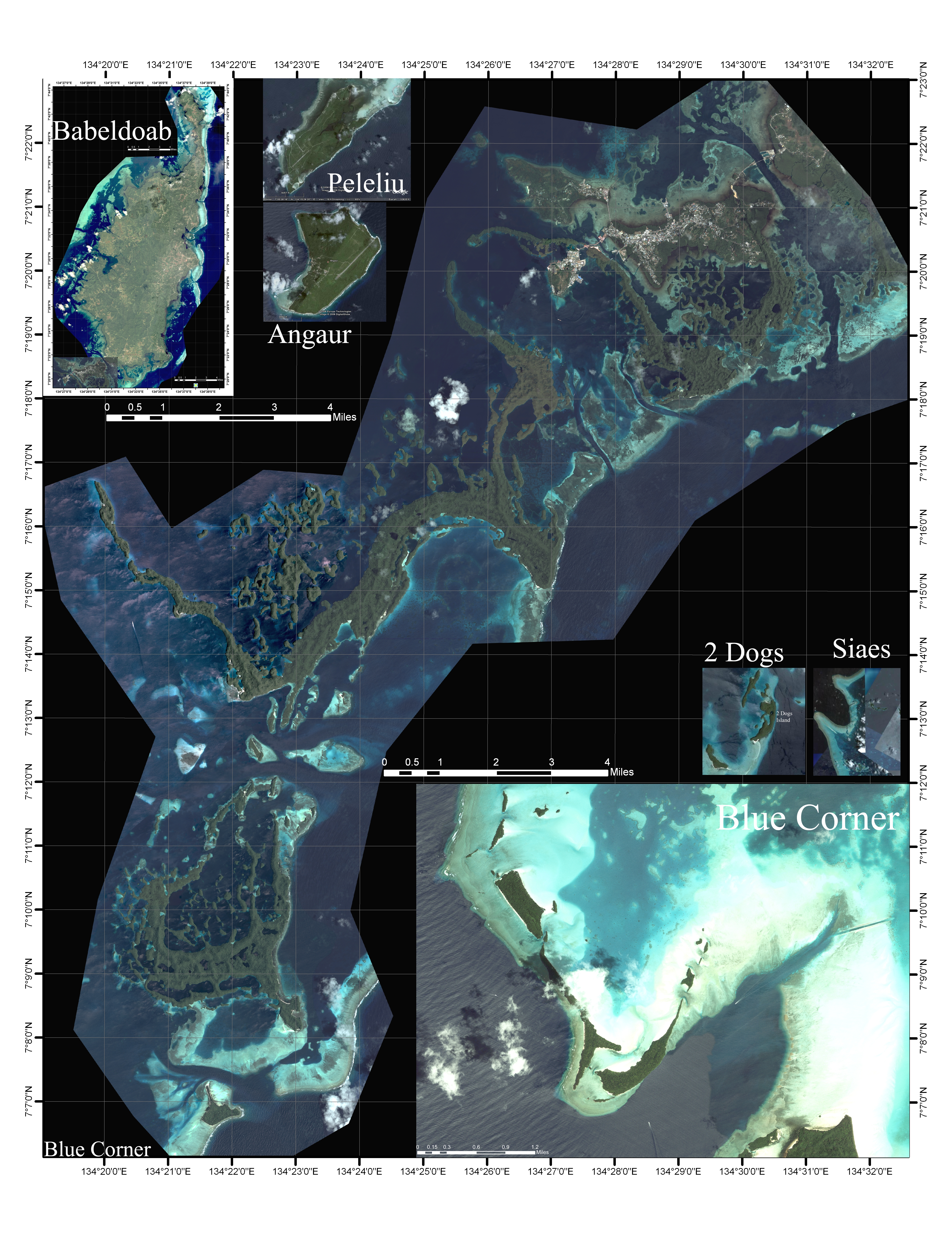
 Note: Each picture has a totally different scale

Babeldoab insert is about 30 miles long.

The Main Picture is about 20 miles top to bottom

Peleliu Island is about 6 miles at the longest point

Angaur Island is 2 and 3/4 miles at the longest point

The Siaes Complex about 12 and `1/2 miles top to bottom

2 Dogs insert is about 1 and 1/2 mile long

If you can not properly display the file on your computer it is probably that you do not have a video card that will support it. Then right click your mouse on the link below and  click the  "save target as..."  link in the pop up window that comes up. This will save it where ever you want to keep it, like in "My Documents" or make a new folder "Crap from Jim". Don't open it just save it. Then you can go to the folder and print the file. It should print as an 'A' size (8 1/2 X 11 inch). It is set at 600 dpi which most color printers can handle.

Right Click here for file

Note: Longitude and Lattitude information printed on the outside of the main picture apply only to the main picture. The Babeldoab picture also has Longitude and Lattitude information printed around it's border.


Click Here to go back to Palau Maps.

email Jim@Loren-Jim.com


Home  Trips SCUBA Genealogy Family Radio Ranching Dogs

Web Design and Visibility by Atwood Webpage Design